Get the most out of your Quad Lock mount on the water with apps specifically for boating, fishing and kayaking.
We’ve rounded up some of the best marine apps that will help you plan the best time to go fishing, make for easy navigation while boating, and track your trips when kayaking.
Using Quad Lock to mount your smartphone keeps it secure while on the water, and within easy reach for you to keep an eye on the weather conditions, record your catches as they happen, and keep in touch with your contacts. We all know some apps can drain your battery, so we recommend adding our Weatherproof Wireless Charger Head to keep your phone’s battery in the green all day. You can also add our Poncho to protect your smartphone from sea spray or splashes of water.
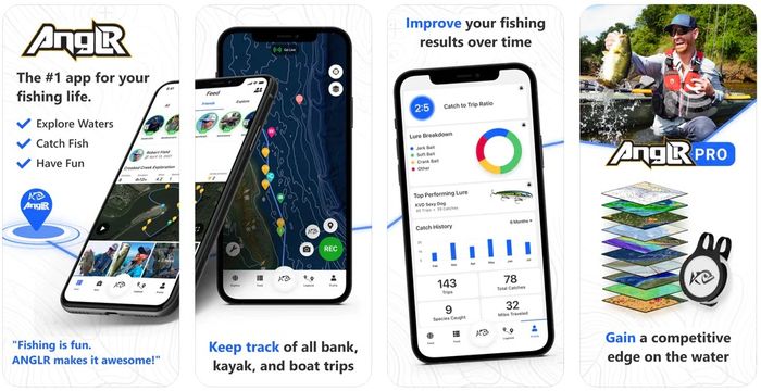
ANGLR
Available in the US. Free and Paid versions available.
Record your entire fishing experience and broadcast live to friends so they can keep up with your catches, GPS position, and weather changes. Join competitions, get expert tips and tricks, and real time weather conditions, catch patterns and gear breakdowns to improve your stats.
Pro version includes 14 advanced mapping overlays, powerful weather and water data, and ANGLR Bullseye, to seamlessly log your catches and gear used.
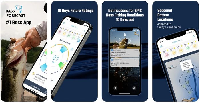
BASSFORECAST
Available in the US. Free and Paid versions available.
Using weather forecasts based on temperature, wind, barometer, sky conditions, moon phases, and GPS specific Solunar data, BassForecast predicts the optimal times to go Bass fishing.
Upgrade to the Premium version to push notifications to your smartphone when forecast is good and epic for your favorite locations, receive tackle recommendations based on your location, and store catch data in the Catch Log.
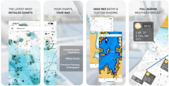
CMAP
Available worldwide. Free and Paid versions available.
Customise chart overlays to suit your needs, view weather data along your route up to five days in advance, and stay connected to others on the water with AIS. Use auto-routing or manually map a route to your saved waypoints, share routes and waypoints with others, and view thousands of points of interest nearby.
FISHBRAIN
Available worldwide. Free and Paid versions available.
Get access to fishing spot ratings and reviews, weather forecasts, logged catches in your area including species and what gear was used, and log your own catches. Upgrade to Pro to save your favorite waypoints on maps, view depth contours, exact catch locations, and best fishing spot predictions.

NAVIONICS
Available worldwide. Free and Paid versions available.
With features such as detailed nautical charts with advanced overlay options, weather conditions and tides, dock-to-dock auto routing, and more, Navionics make it easy to plan your next journey on the water. Satellite overlays with SonarChart shading help you see what is below you on the seafloor and lake bottom. Stay connected to friends and fellow boaters using AIS, or make connections and share your routes and waypoints.

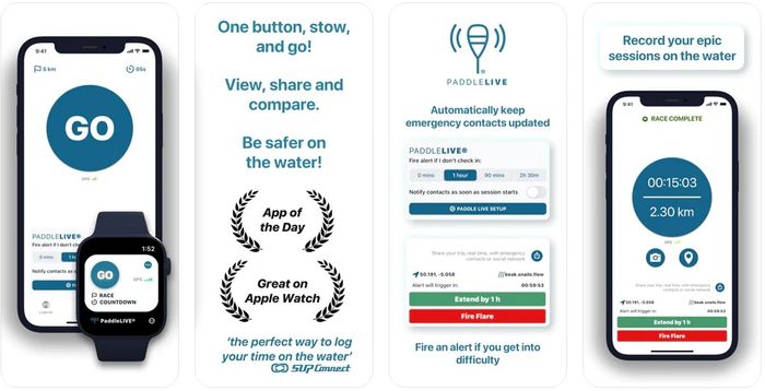
PADDLE LOGGER
Available worldwide. Free and Paid versions available. Currently only available for Apple iPhone.
Track your journey with your smartphone's GPS, view your paddle statistics, share your trip map and data on social media.
Upgrade to the Pro version for the safety feature of non-intrusive regular check in while recording a trip, and real-time GPS sharing to your emergency contact, send an alert if you get in trouble, as well as additional features to give better insight to your trip and additional stats.
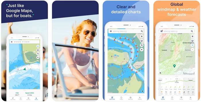
SAVVY NAVVY
Available worldwide. Tiered Paid versions available.
Nautical charts, GPS active tracking, trip planning, marina and anchorage information, automated weather and tidal routing, distance measurements and automated CTS (Course To Steer.)
Upgrade your plan to have access to tidal heights graph, offline charts and weather, export route to chart plotter, and more.
Got another app you use while out on the water you think we should know about? Let us know in the comments below, or share your photos of your smartphone mount with us on Instagram @QuadLockMarine
Build your own mount using the Quad Lock Marine Kit Builder, or simply buy individual parts through shopping the Quad Lock 360™ range.